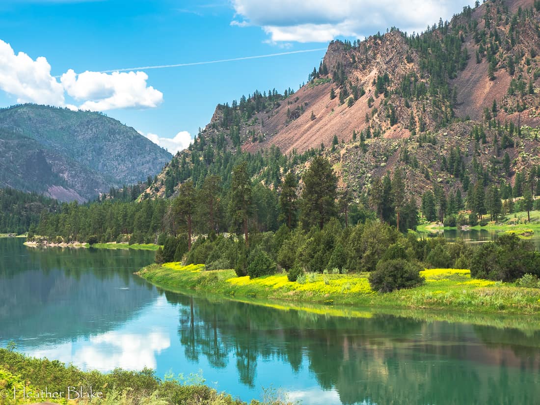
While Exploring the Northern Rockies, we followed the Clark Fork River in western Montana. This river is so calm and tranquil, that I thought it was a lake! Some parts of this river are as wide as a lake so it was a little deceiving! The water is really this clear and blue! Wow!
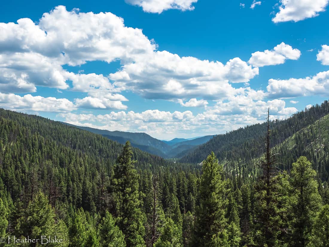
Well here we go, the continuation of the Western Scenic Byways tour takes us Exploring the Northern Rockies through Idaho and Montana! I love this part of the world as it seems that each view gets better and better than the last one! It boggles my mind with how beautiful America is. As you will see throughout this post, the pictures say it all!
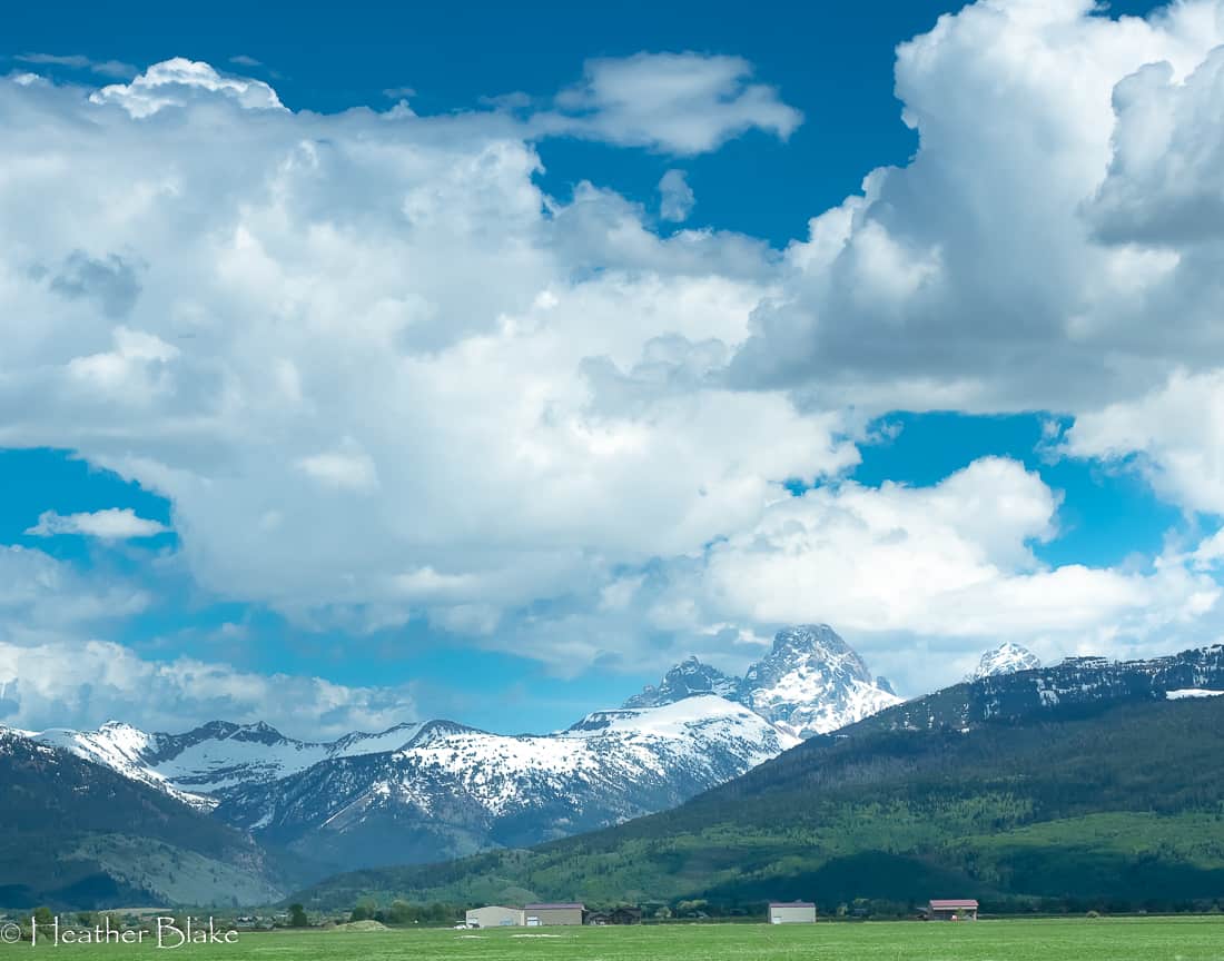
Scenic Byway 33- The Teton Scenic Byway
As we went over Teton Pass, the road quickly took us into Idaho. I was really excited to go on this side of the pass as it’s been since the mid-1980s since I skied Grand Thargee when I was a kid. It was also exciting as last years Ultimate Summer Roadtrip took us on the east side of the Tetons so seeing these majestic mountains from the other side was neat! The best part, there are no crowds!
Driving on Scenic Byway 33 (Teton Scenic Byway) is one of the prettiest drives that you will ever take as it is part of the Yellowstone Grand Teton Loop. The road takes you through quaint western towns like Victor and Driggs and follows the Teton mountains the whole way. The farm and ranch lands are just gorgeous.
It was early in the morning on this part of the drive and I didn’t see any places to camp in the vicinity, but that’s ok. Just follow along!
Scenic By-way 33 near Driggs, Idaho offers some of the best views of the Teton Mountains. Can you imagine owning this ranch and have the Grand Teton mountain in your back yard?
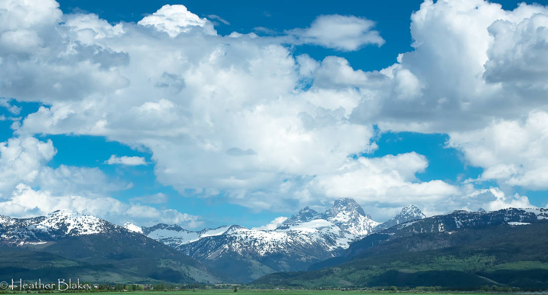
If Driggs, Idaho wasn’t so cold in the winter, I would move there just so that I could see this view every day!
Driving through Ashton, Idaho
I love to do research on trips and one of the interesting things that I have learned on my travels is that Ashton, Idaho is the “seed potato capital of the world”. Wait, what? I guess from what I have researched is that the Idaho Potato Association has strict rules on where and how the seed potatoes are produced and the farmers need to be certified to grow them. The farmers in this area adhere to the strictest growing standards to produce the best seeds for potatoes. Next time that you eat a potato, think of Ashton. 🙂
Ashton is also at the junction of the Teton Scenic Byway and the Mesa Falls Scenic Byway. It’s a blink of a town and one to make a decision on where to go. We chose to go up the Mesa Falls way, find a place to camp and check out the famous waterfalls!
Seed potato farms are abundant in this part of Idaho. All the plants were coming up nicely. I’m sure the farmers were happy!
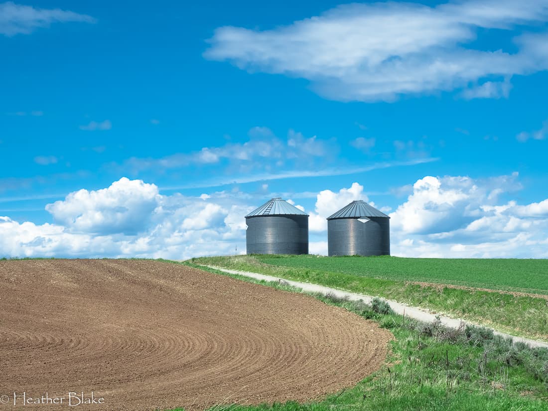
A simple pretty picture of silos near Ashton, Idaho. Look how perfectly plowed the field is. I wonder what they are planting next?
Exploring Scenic Hwy 20- Mesa Falls Scenic Byway
Mesa Falls Scenic Byway is a magical 30-mile road that winds through the Thargee National Forest that will eventually end in West Yellowstone. It’s gorgeous and remote. There is tons of dispersed camping along this road so just keep your eyes open. We, however, needed to fill up on water so we decided to camp at the Warm River Campground instead of boondocking for the night. The campground had a lovely setting located right on the Warm River, it was clean and the camp hosts were a hoot!
A funny tidbit that I learned from a bit of research, Warm River is the smallest town in Idaho. Population, 3 people…
After a lovely evening, we got up in the morning and drove up the hill to the Mesa Falls interpretive center. This is a “must-do” stop if you take this road. The lodge on-premises is a great place to delve into the history of the area, the importance of the waterfalls and a great presentation of the animals in the area.
Once you spend some time at the lodge, take the short walk down a paved trail to the upper falls. The Snake River is beautiful here and the power of the waterfalls is impressive. It’s a great photo opportunity for sure!
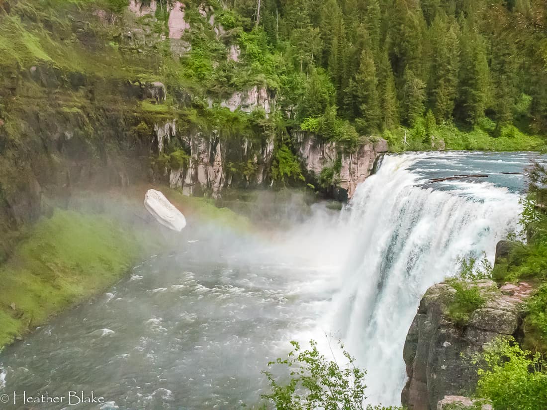
Meas Falls is a must stop at thing to see when traveling on scenic by-way 20. The upper and lower falls are simply gorgeous!
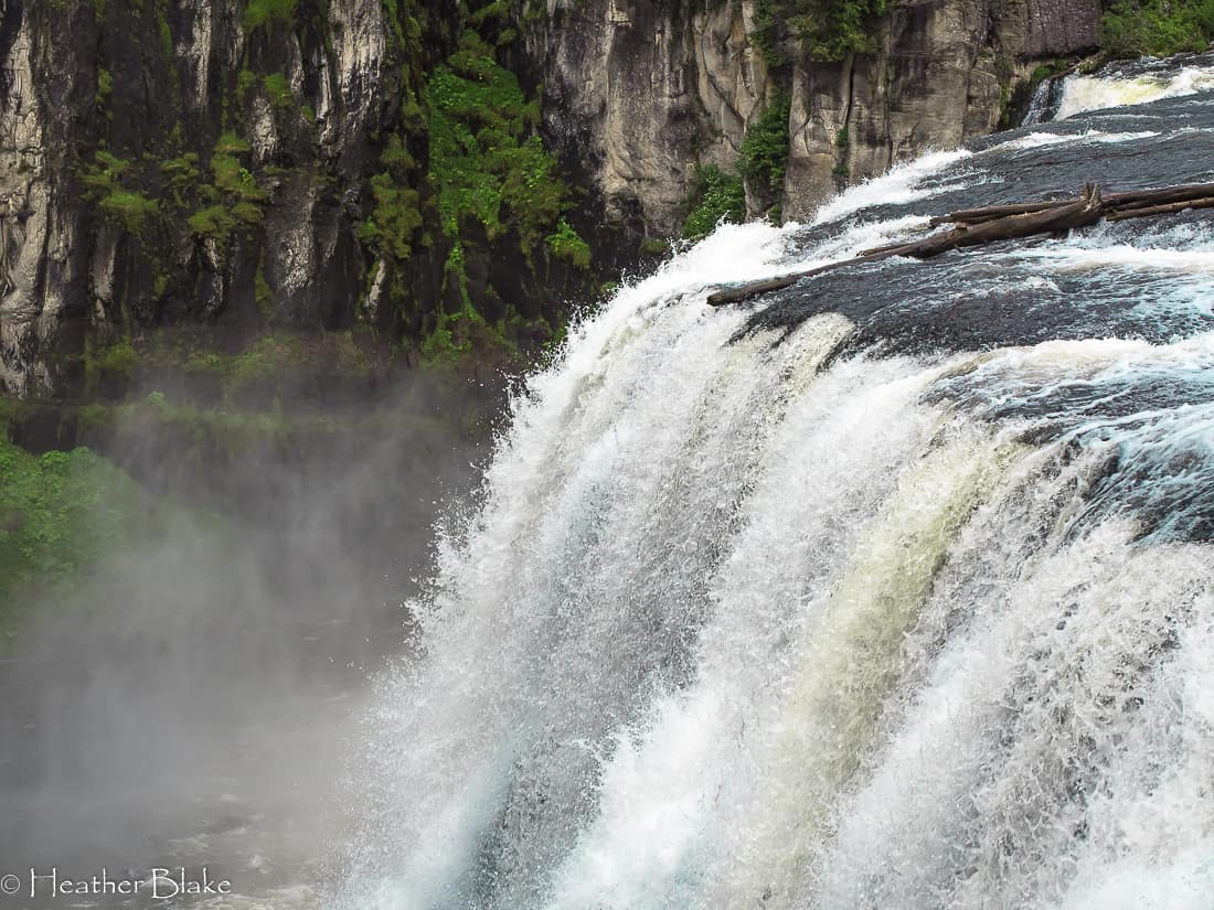
Check out the power of Upper Mesa Falls. It’s a great stop if you are on your way to Island Park and West Yellowstone!
Traveling Sacagawea Historic Byway
After leaving Mesa Falls, we decided to backtrack a bit and head towards Rexburg. We wanted to get up by Salmon, ID for the night and the Sacagawea Historic Byway was the best way to go.
Rexburg is a great place to stop, go to the grocery, get gas, fill up with water, etc. It’s a historic old town with wide streets and lovely old buildings. If you do stop in Rexburg, look out for the orange flags… This is the first place that I witnessed this quirky Idaho law!
Historic Byway 28 is about 120 miles long and is very remote! I think we passed 2 cars on the entire road! You will find free camping along the route but it’s not too exciting so we stopped at the general store in Tendoy to ask where to go. Wouldn’t you know it, the shop owner and a local cowboy were very helpful and as luck would have it, we stopped in the right place!
Tendoy is where you get on the Lewis and Clark Backcountry Byway. This is a dirt road track that eventually takes you over Lemhi Pass which is the place where Lewis and Clark first met Sacagawea. It’s a very beautiful and historic spot. There are about a dozen or so free campsites up the righthand fork in the road on the right side, up 3-4 miles or so! There is a small creek that you will be able to camp on and is some great hiking here as well!
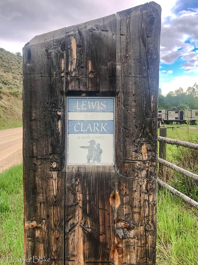
The Lewis and Clark Back Country Byway is a 26-mile loop where the men first met Sacagawea. It’s a neat boondocking site to boot!
Discovering Sharkey Hot Springs
At the General Store in Tenroy, the cowboy that we spoke with told us about the Sharkey Hot Springs that are located in the hills off of the Backcountry Byway. I have never been one to turn down a hot spring, so I was certainly not going to miss this opportunity!
Here is how you get there. Just up past the General Store, you can go right or left to access the Backcountry Byway. Take a left here and follow the road up a couple of miles and the springs are on your right. There is a small $3 usage fee to access the hot springs.
The spring is very nice, clean and there are changing rooms available as well. It was a perfect place to start the day. I’m not sure there is anything better than a hot cup of coffee and a hot spring soak!

A perfect place to enjoy the morning coffee! There is nothing better than a hot coffee and a hot spring!
Exploring Salmon, Idaho into Montana
After a nice soak and some breakfast, we headed up towards Salmon, Idaho. Salmon is a cool old town that has a vibrant downtown, with galleries, coffee shops, restaurants, and local shopping. Make sure that you stop in the Jaxonbuilt hat shop. It’s a great place to admire (and buy 🙂 ) a custom-built hat to suit your needs. Their products are unique and one of a kind! Be sure to check it out!
Salmon is also known for its world-class fishing and rivers for rafting and kayaking. Besides being an outdoors person’s paradise, you can also check out the Lemhi County Museum and History Center or the Sacajawea Interpretive Center. This part of the state has so much history. It’s worth a bit of time to learn something while you pass through! Salmon, Idaho is definitely a place that I’d like to spend a few days exploring!
At this point, we got onto the Salmon River Scenic Byway (HWY 93) and headed to Montana. It is a beautiful drive that takes you over Lost Trail Pass and is a continuation of the Lewis and Clark Trail as well as the Nez Perce (Nee-me-poo) National Historic Trail. It’s just a neat drive with many places to stop for some learning and photo opportunities!
A quick stop in Missoula and then North
We continued on HWY 93 into Montana! The views are just lovely on this part of the state, however, Missoula is a larger city so the suburbs start way out. So I won’t say too much except that I think Missoula is a fantastic small city. It’s very charming and offers lots of great activities and restaurants! We have friends who we stay with so it’s just a nice stopping point us before we forge on!
If you are looking for camping in this area though, Lolo Pass has plenty of camping! 🙂
Montana bound! HWY 93 will take us up to Missoula, Montana. We took the scenic route! lol!
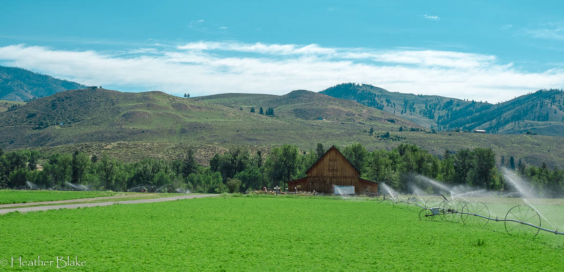
I want this barn. Just saying! It’s idyllic!
Heading North towards Canada
Our goal on this trip was to avoid as many crowds as we could and get as close as we could to the Canadian Border as possible. Well, here is where that starts to happen. After leaving Missoula, we scooted out of town and headed northwest on HWY 200. This is a great drive and it only gets better the further north that you go!
The cover photo is a picture of the Clark Fork River. I’d be hardpressed to say that, the Clark Fork is one of the prettiest rivers that I have ever seen! It’s crazy to know that this river was so polluted from the Super Fund Site in Bonner’s Ferry that no fish or anything for that matter lived in it! Anyhoo, it’s all cleaned up now and it’s a continuation of the Lewis and Clark Trail.
I did notice numerous camping in this road and if you are interested it’s famous for it’s fishing and float trips in spots!
The Fish Ladder @ Thompson Falls
When you are on HWY 200 you will have to drive through Thompson Falls. It’s a nice town and a great place to fill up with water, gas, and propane! I also noticed quite a bit of camping in the area, however, the big attraction here is the falls!
There is a lovely walk out to the falls in the center of town, Just ask one of the friendly locals and they will tell you where. It goes over an old bridge and out to an island where you get the perfect view of the falls and the fish ladder.
The fish ladder is one of the most ingenious things that I have ever seen and was built to help the spawning fish to climb up the 75-foot dam. Basically, the fish congregate at the bottom of the ladder where they get pulled in. They travel up like 48 or so compartments before they get let off above the dam so they can swim upstream!
It’s definitely worth seeing if you pass through Thompson Falls.
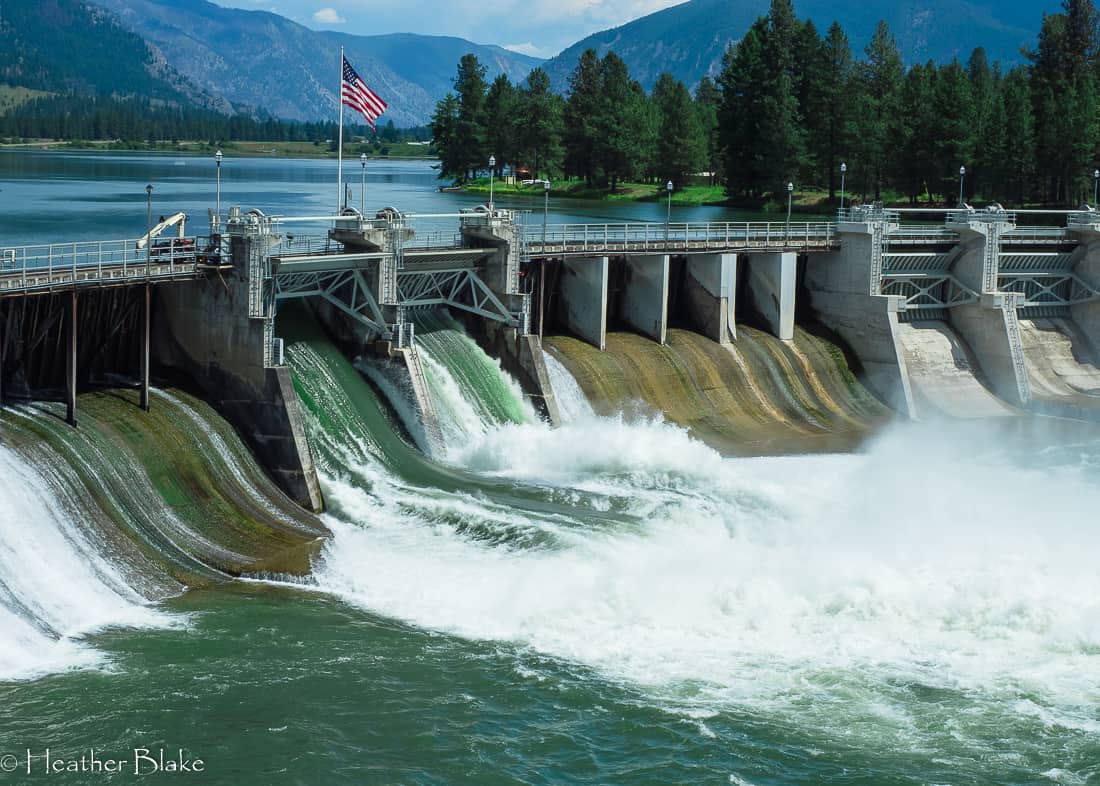
Walking out to the viewpoint to see Thompson Dam is worth every minute! It’s quite impressive!

I have never in my life. A fish elevator. The little fish swim to the base of the dam, where they are scooped up and taken for a ride up to the Clark Fork river! This was very impressive.
Scenic Hwy 56- Bull River Valley Scenic Hwy
The Bull River Scenic Hwy (Hwy 56) or affectionately known as part of The Highway To Heaven loop is an absolutely gorgeous 30-mile drive that follows the Cabinet Mountains and Bull Lake. This area is absolutely a fantastic place to camp, go fishing, boating, and hiking. It has it all and is pretty much one of the most remote areas that I have ever been too! Make sure to check out the Ross Creek Ceder Forest while you are in the area. The smell of the cedar trees is intoxicating!
Highway 56 dead-ends into Scenic Hwy 37- Lake Koocanusa Scenic Byway. Here you have a choice. You can go right and go towards Kalispell or go left and head towards Idaho. We went left and stopped in the darling town of Troy. Troy is a cute town and a good place to get gas etc before heading west. We stopped at the visitors center for the internet as we didn’t have it for almost 24 hours. So if you need to connect, this is the place to do it!
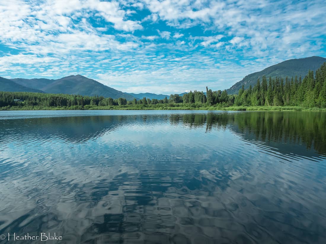
It was a beautiful morning to take a walkout to Bull Lake. Can you say peaceful?
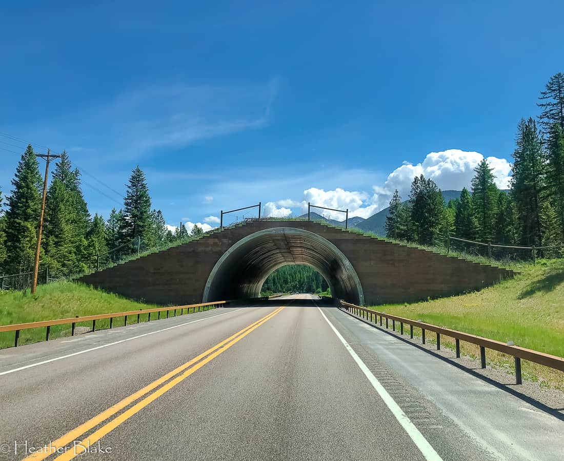
These are always fun to drive through. A big game bridge allows the elk, deer and, moose to do their thing without worry! This one is in Montana but I have seen them in Colorado as well! It’s ingenious!
The Final Stops before getting to Washington State
Gosh, Exploring the Northern Rockies is quite an adventure for sure. We ended up with this part of the trip going through the very northern part of Idaho. After leaving Troy, we crossed into Bonner’s Ferry down to Sandpoint and into Washington state. This whole part of the trip took maybe 1 1/2 hours. We did stop in Sandpoint which I loved as it is on the beautiful Lake Pend Oreille. I know everyone goes to Coeur d’Alene but we don’t like crowds and wanted to stay as north as possible, so Sandpoint it was. Sandpoint is definitely a place to go back to but it is very difficult to get up there!
Exploring the Northern Rockies
Thanks for following me along while we were Exploring the Northern Rockies. Next Stop, Adventures in Washington State! I can’t wait to share this part of the trip!
For other travel and adventure ideas, check out my past posts!
Big Southwestern Roadtrip-Arizona