
Technically Cottonwood Pass is not part of the West Elk Loop Scenic Byway but it’s where we began our trip. Starting in Buena Vista, Colorado is a great place to begin! The road is so new that there aren’t any markers yet. Meh, who needs road markers anyway!
A few weeks back we did a quick RV road trip through Colorado. Time was not on our side, so I picked out a quick route that I have never done before but have always wanted to do! I looked at the atlas and saw this cool loop that we could do in 3-4 days. Who would have known that it had a name! The West Elk Loop Scenic Byway. I wanted to get this posted now because the leaves are starting to change in the mountains and this would be a glorious drive to see the change!
West Elk Loop Scenic Byway
Theoretically, the loop begins in Carbondale off of I-70 but traveling on I-70 isn’t what we do, so we headed out of Denver on HWY 285 to Buena Vista where Cottonwood Pass begins. We also adjusted the route a bit on the way back and went through Gunnison, over Monarch Pass to HWY 285 to get home. I really enjoyed my version of the West Elk Scenic Byway. We saw a bit more and got an extra night of camping in!
Follow along as I will let you know what to see and do, where to camp and things not to miss!
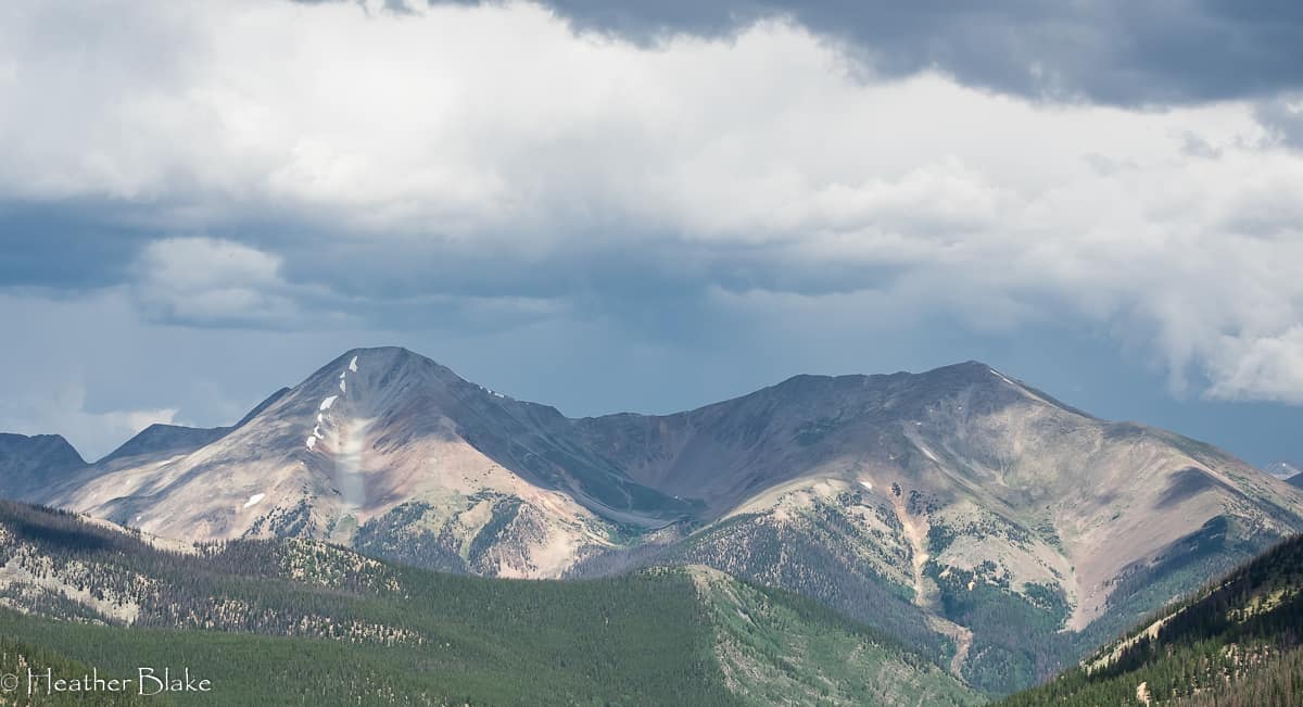
Cottonwood Pass, Buena Vista Colorado
I am lucky enough to leave within a 2-hour drive from Buena Vista. It seems to be a place that I gravitate to a few times a year. Anyhoo, BV is also where Cottonwood Pass begins. It’s easy to find. Turn west at the only stoplight in town. That’s it.
Cottonwood Pass is opened seasonally. Generally, May-October depending on the weather. It’s one of the prettiest drives that you will ever take and now that it is recently paved it’s an easy drive. There are some steep spots and some crazy switchbacks, but that’s what you should expect from high pass mountain driving, so be prepared.
Near the BV side of the pass, there are some hot springs that are nice (we didn’t stop this time). Cottonwood Pass is also where you access many trailheads for hiking numerous 14’ers which BV is famous for. Along with the hot springs and hiking, there is a plethora of free camping all along the pass. Keep your eyes open and you will find camping which is suitable for smaller RV rigs. Just remember, this pass is very high (over 12,000 feet) so it gets cold up there. Even in the middle of the summer.
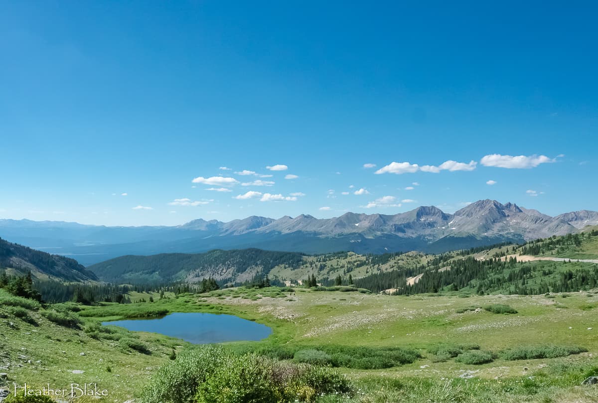
Make sure to stop at the top of the pass. As you can see from the pictures, the views are outstanding! It also crosses the continental divide which is always a good photo op!
Photos from Cottonwood Pass
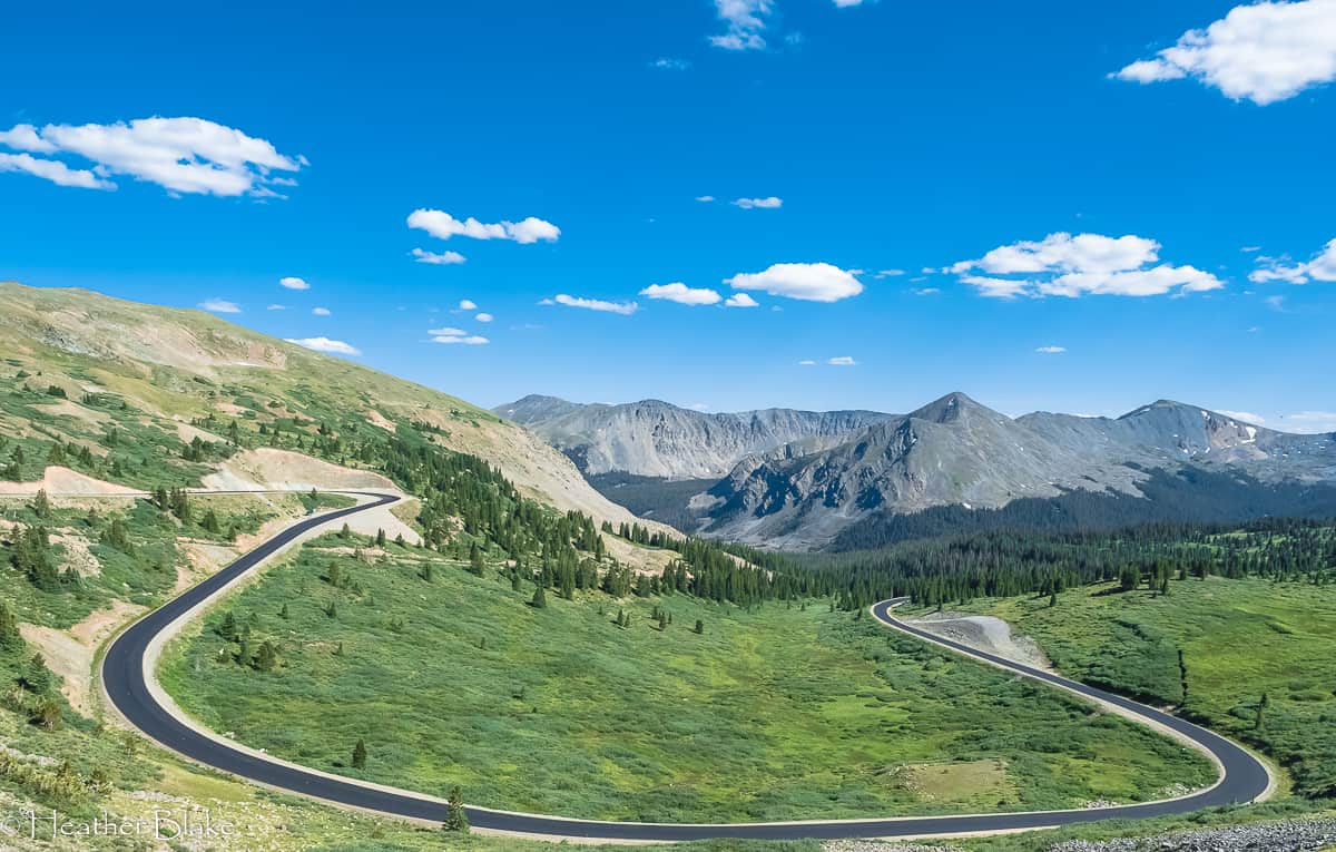
Check out this newly beautifully paved and umm, the curvy road up Cottonwood Pass! No fast driving here. Now that’s what they call a switchback!
Cottonwood Pass is the highest improved state road in Colorado and the highest paved crossing of the Continental Divide in the country. Pretty neat! The views are stellar and there is a ton of hiking available from the parking area at the top!
Taylor Reservoir
Once you come off Cottonwood Pass you drop into Gunnison County and you see this incredibly beautiful body of water, the Taylor Reservoir. This area of Colorado is a sportsman’s paradise. The fishing is world-class, there are OHV trails, hiking, biking, rafting, snowmobile trails, and boating you name it, you can probably do it there! There is also a plethora of campsites available, both dispersed and paid. Keep your eyes out for campsites. You will find one.
Once you drive around the south side(ish) of the reservoir you will be in Altmont, Colorado. This town is rich in mining history and still has many of the original cabins intact. It’s cool. There is a general store and National Forrest access. We went up one of those roads in town to find a camp spot. It was a lovely place in a small canyon and incredibly dark at night. Perfect.
Altmont is also where we started out on the West Elk Loop Scenic Byway.
Photos from Taylor Reservoir
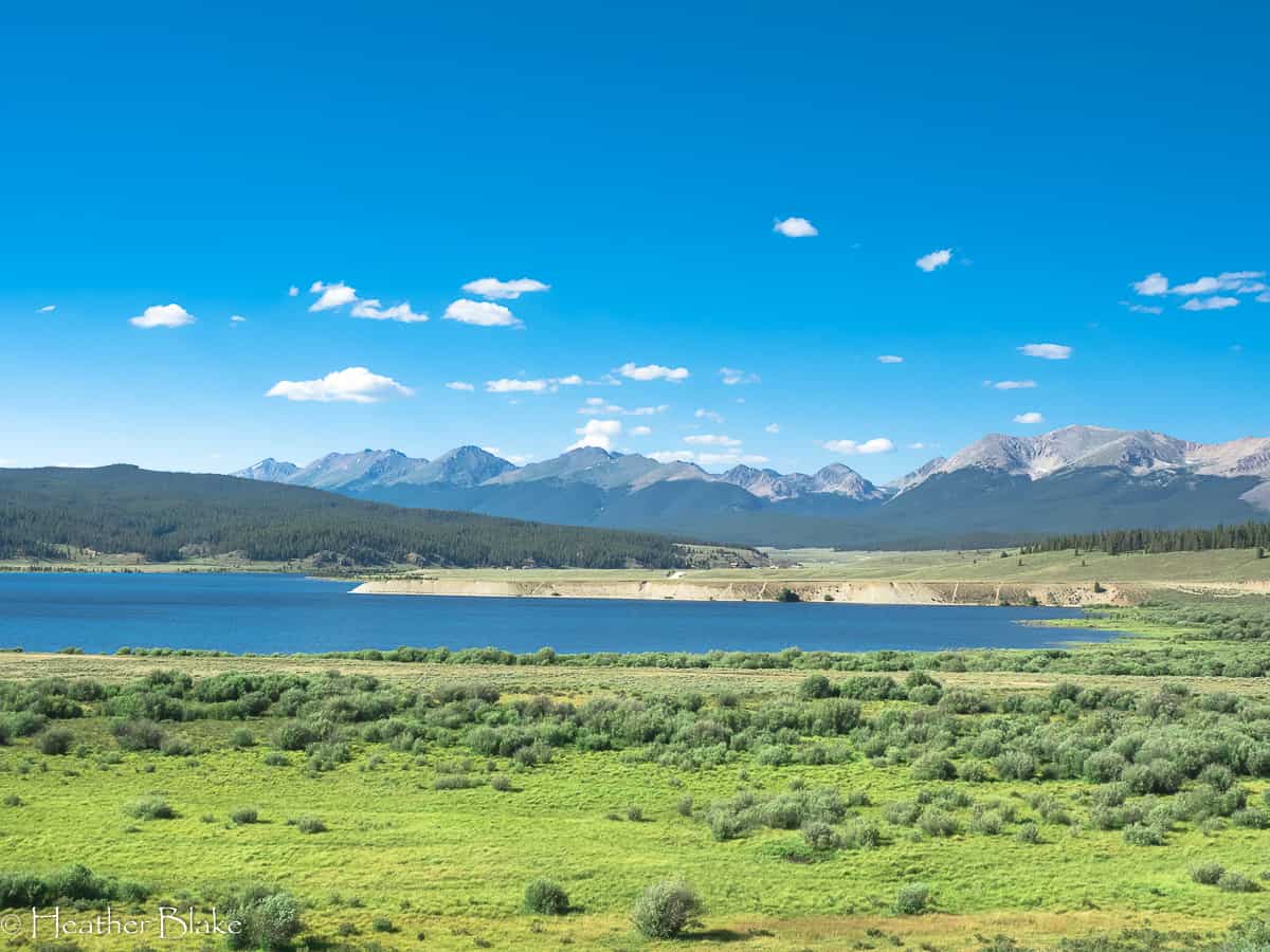
The views coming off of Cottonwood Pass were breathtaking. This is the Taylor Reservoir which is known for its world-class fishing and outdoor recreation.
Crested Butte, Colorado
Ah, Crested Butte! Such an amazing quintessential western town. It’s flat out cool.
I haven’t been to the “Butte” since 1993 for a ski trip. All I remember was like 10-feet of snow and some damn great skiing. I was young and all that I cared about was deep snow and crazy steep trails. Fast forward 26 years, I appreciate a whole lot more!
Crested Butte is the wildflower capital of Colorado and is not only known for its amazing skiing but its mountain biking as well. In fact, CB claims that it was one of the first towns where mountain biking began! As you can imagine (if you are a mountain biker) the trails would be out of this world good!
The old town main street is a perfect representation of what you would think an old western town would be like! It’s perfectly restored and just darn charming. Make sure you spend some time in this town for a stroll down the main street. The people are friendly and there are tons of restaurants, bars, shops and places to grab a coffee.
I didn’t notice any camping in the vicinity of CB as, like any Colorado mountain town, they are becoming over-populated. Don’t worry though. Follow along, outside of town there is plenty!
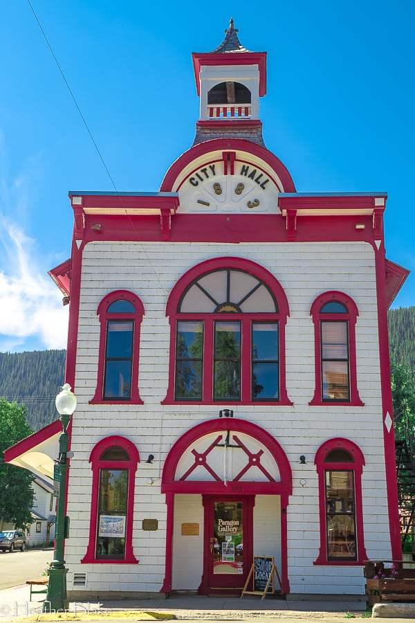
The last time that I visited Crested Butte was probably 1993. It was winter and there was at least 10-feet of snow on the ground! It was fun to see this magical place in the summer. I loved all the old and perfectly restored buildings!
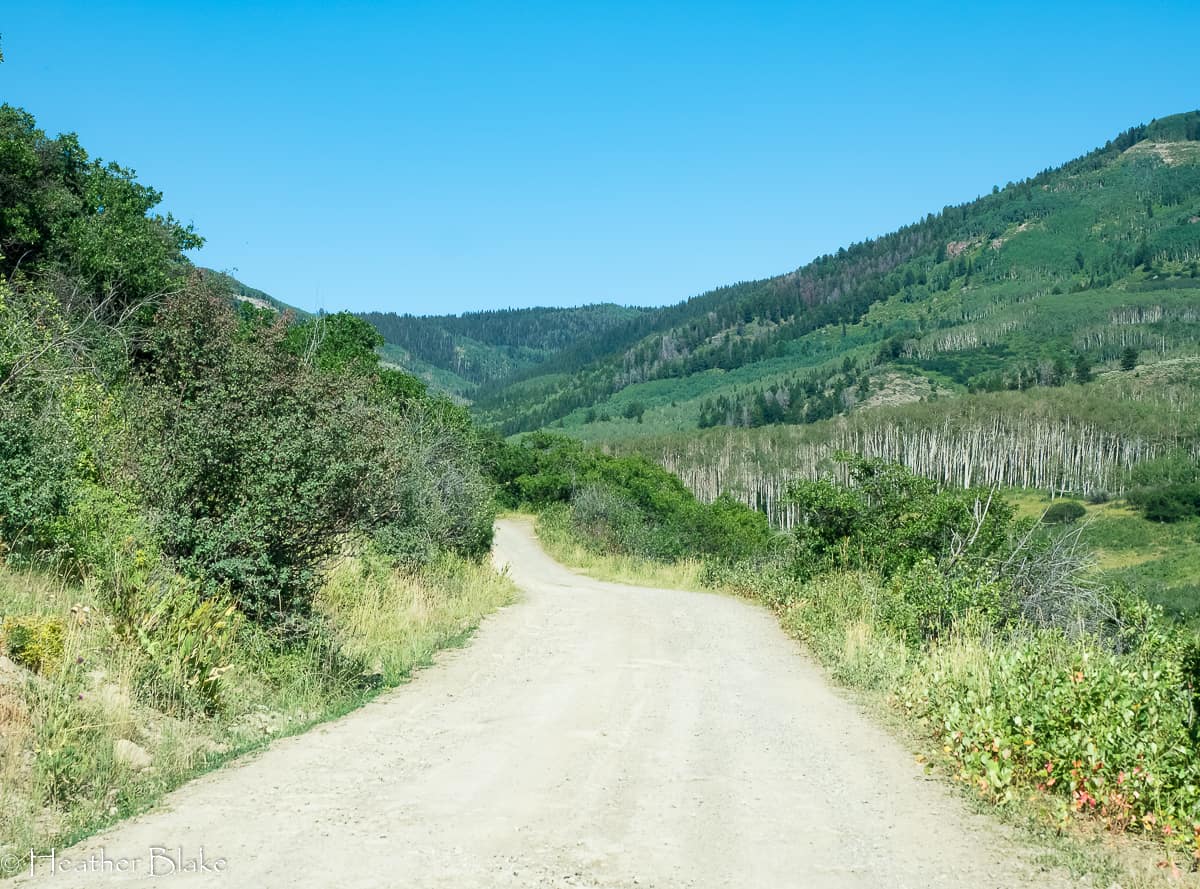
Kebler Pass
In the center of Crested Butte (next to a gas station), you will see a sign for the West Elk Loop Scenic Byway, turn here to go up Kebler Pass. This is where the trip gets spectacular and where you will experience one of the greatest aspen forests of all time.
Like many Colorado mountain passes, Kebler Pass is opened seasonally. Generally, May-November. It’s not as high as other mountain passes but it is a well-maintained dirt road. We easily crossed it in a 27-foot RV.
Kebler Pass had beautiful wildflowers when we went over but it’s known for its aspen forest. It’s the third-largest aspen forest in the country and I’d be lying if I wasn’t impressed by how huge these trees are. We are going on another RV trip next week and I hope to go over this pass again to experience one of the best places in the state to see the changing leaves. Fingers crossed!
There are a few paid campgrounds on Kebler Pass along with many dispersed campsites. Keep your eyes open and you will find one. If you are interested in a paid spot, check out the 2 lakes on the pass. They both have campsites available!
Pictures from Kebler Pass
Kebler Pass is one of the prettiest passes in Colorado. The road is paved just outside of Crested Butte but quickly turns to dirt!

Kebler Pass is a well-maintained dirt road that offers some of the most incredible views of the mountains and the majestic aspen trees. I can’t wait to go back!
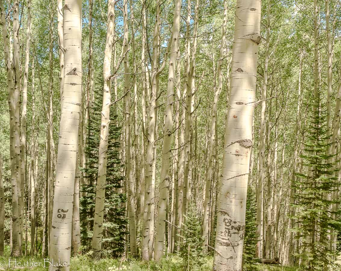
I’d be hard-pressed to say that I have ever seen a more impressive aspen tree forest than the one on Kebler Pass. These beauties were very tall and some were like 4-feet around! That’s big for an aspen tree!

One thing that Colorado offers is some fantastic views! This one is one of them! This view is courtesy of Kebler Pass!
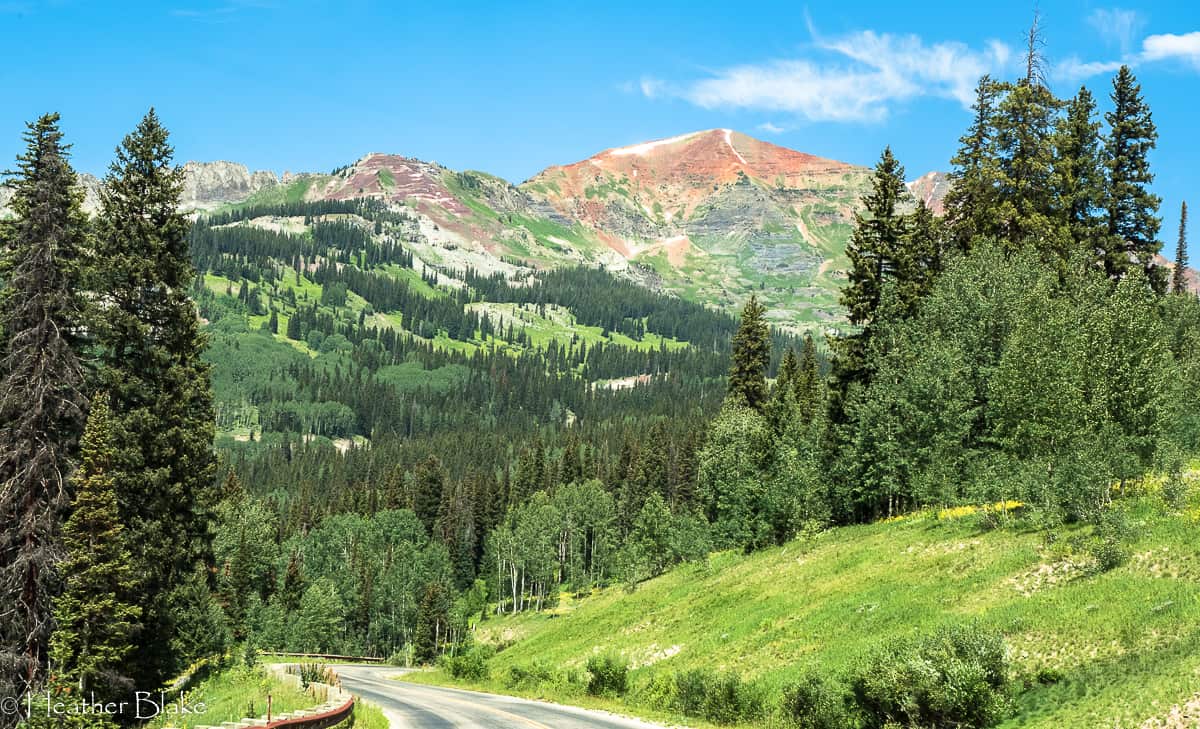
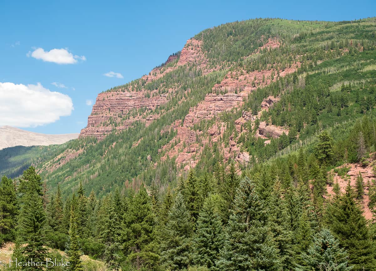
McClure Pass and Beyond
When you come off of Kebler Pass you dead end onto HWY 133. Here is where (if you were coming from Carbondale) meets the West Elk Loop Scenic Byway. Since we were intrigued by being on this loop we decided to head north a bit to see the towns of Redstone and Marble. Good thing we did, they are both worthy stops on any journey. The bonus of this part of the trip, McClure Pass.
Redstone, Colorado
I have heard of Redstone before but had no idea what to expect! When you say “small town”, this constitutes for that. Population, 130 people. Redstone is beautiful and quaint and definitely worth a stop. It’s also on the National Historic Register. There is a general store, shops, ice cream, coffee and a couple of B&B’s. There is also a “national forest” campground that costs $30/night. Um, no.
Redstone is famous for its coal mining history. I know people don’t want to talk about coal mining but this area is rich with it and many towns in this (still active) area have thrived for over a century because of it.
Two of the unusual and historical markers in this town are the “cokers” and the Redstone Castle. Check them out because this town deserves a couple of hours of your time!
Oh, buy some fudge when you are there! Delicious! You can’t miss the sign! 🙂
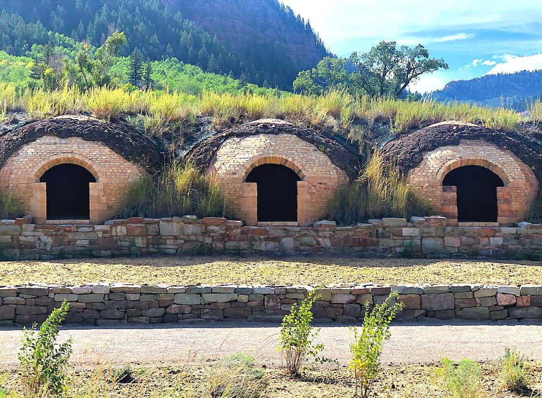
Wow! Check out this piece of history that sits on the side of the West Elk Loop Scenic Byway. Seriously on the side of the road! Stop and take peek of history here.
Marble, Colorado
Ah, Marble, CO. I so wanted to see the most famous photographed places in the state, the Crystal Mill, and we wanted to find a campsite. We didn’t luck out here.
Marble, CO was famous for its marble production. (the marble from the mine was used to build the Tomb of the Unknown Soldiers and the Lincoln Memorial) and the Crystal Mill was used as a water turbine system to generate power for local silver mines in the day. Both incredible accolades to this itsy bitsy town!
That being said, I will go back here with my 4×4 vehicle. The town is accessed by dirt roads that are not easily accessible with an RV.
On a final note, there are two paid camping areas in Marble. They have a hefty fee. Like $25-$30/per night. A no-go for us but if you choose to stay here, make sure you have a 4×4 in tow to see the sights!
McClure Pass
As Colorado mountain passes go, McClure Pass is pretty unremarkable. Yes, it’s beautiful, yes it’s steep (8% grade in places), yes it has mountain views but it’s a major thoroughfare. As it goes, when all else fails on free camping, the top of McClure Pass came to the rescue here! (There is always a place). Thank God, it was getting late!
When we crossed the pass earlier in the day we saw a man hanging out with an umbrella. When we approached the summit later, he was still there so we stopped and asked what the heck he was doing there we also wanted to ask him if he knew where we should camp! An interesting story ensues…
I’ll start with the good first, he suggested that we take the dirt road where he was sitting, and drive up and promised great camping! He did not steer us wrong. It was a long, un-maintained road that was really bumpy, but we found a great spot on top of the mountain with killer views, a perfect campfire, and a super bright milky way. It couldn’t have been better!
If you have rig bigger than 27-feet don’t bother here. This was a rough road. If you have the same size or smaller, go for it. The pasture at the top is amazing!
Interesting Facts Presented By A Federal Employee:
My question to the federal worker counting cars for the national forest service was, “why are there NF campgrounds that are ridiculously expensive”? We have noticed this in a few states such as Washington, Oregon, and Colorado. His response… “it’s a way for states to generate funds for a “pay to play” fee. Hum… excuse me while I cough. The states basically take over (his words, not mine) “federal lands” that we all pay taxes for so that they can do a half-ass job managing and charge an inappropriate amount for a spot with a fire pit. It’s basically a money raiser for the states and a “fee” that no-one knows about and easily swept under the rug which no-one will argue with. Wow! I got my question answered.
Pictures from McClure Pass
A pretty view of the Redstone coming down from McClure Pass. IT’s actually a total change of scenery from what we had been seeing! Still big mountains though!

Yep! This is a road that we took the RV up to find a boondocking site! It looks tame but in reality, it was one bumpy ride!

Me and the pictures that I take looking through the windshield! Good thing we can keep a clean window! This one is our decent down McClure Pass!
Paonia, Colorado
On of the towns that you must stop on the West Elk Loop Scenic Byway drive is Paonia. Paonia (which is a mis-spelling of Peony) is fondy referred to as “the coolest town in Colorado”. It’s known for its orchards, wine production, its livly art community, its festivals (they have a lot) and for bringing the farm to table movement to the state.
Spend some time driving around the beautiful farmland to truly enjoy this special place, we did!
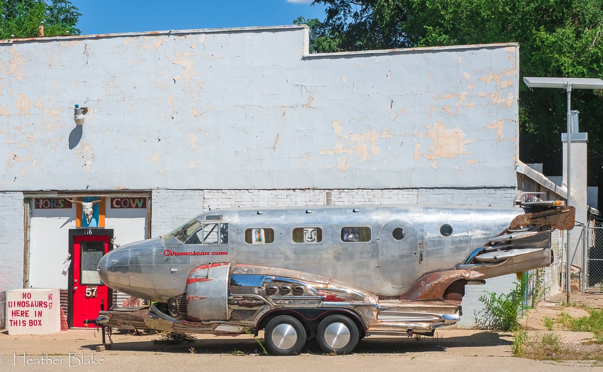
The fun thing about traveling is that you see some quirky stuff. This constitutes for this. I have no idea what “this” is but look at the cast of characters in the windows. Hilarious!
Black Bridge Farm and Winery
While driving around, we stumbled upon this bridge and right behind it is the entrance for Black Bridge Winery and Orchard. They have a great shop where you can buy all kinds of goodies hand made on the farm along with a peach orchard where you can pick your own peaches! I have always wanted to “pick” something and today was the day!
We hung out here for a couple of hours, picking peaches, walking in the orchards and sitting in the chairs by the river. It was a lovely afternoon for sure!
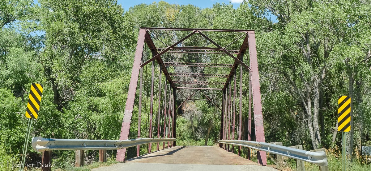
Black Bridge is a cool old railroad bridge that we crossed before we went to the Black Bridge Winery and farm to pick fresh peaches, buy some goodies and sit in their beautiful back yard and enjoy the river view!
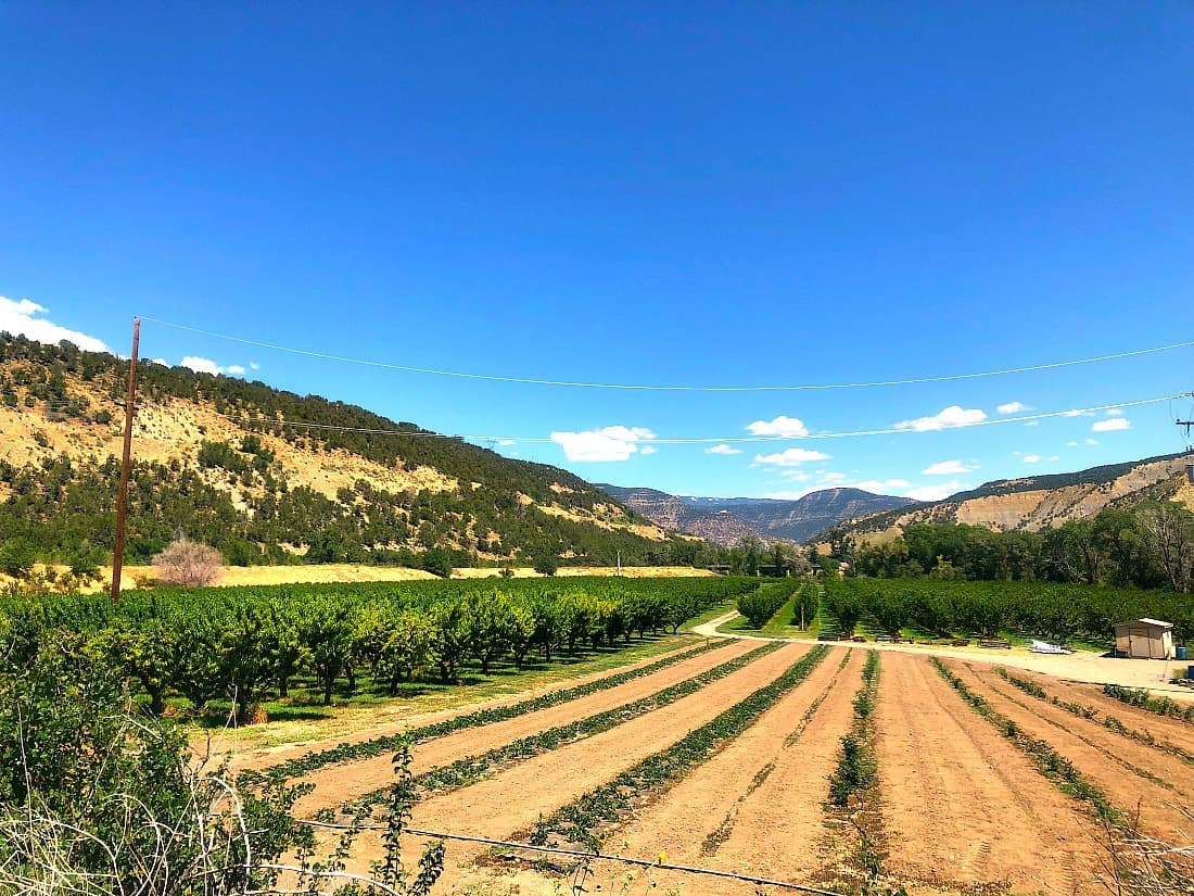
Check out this beautiful peach farm! Hanging out here for a few hours was a whole lotta fun!
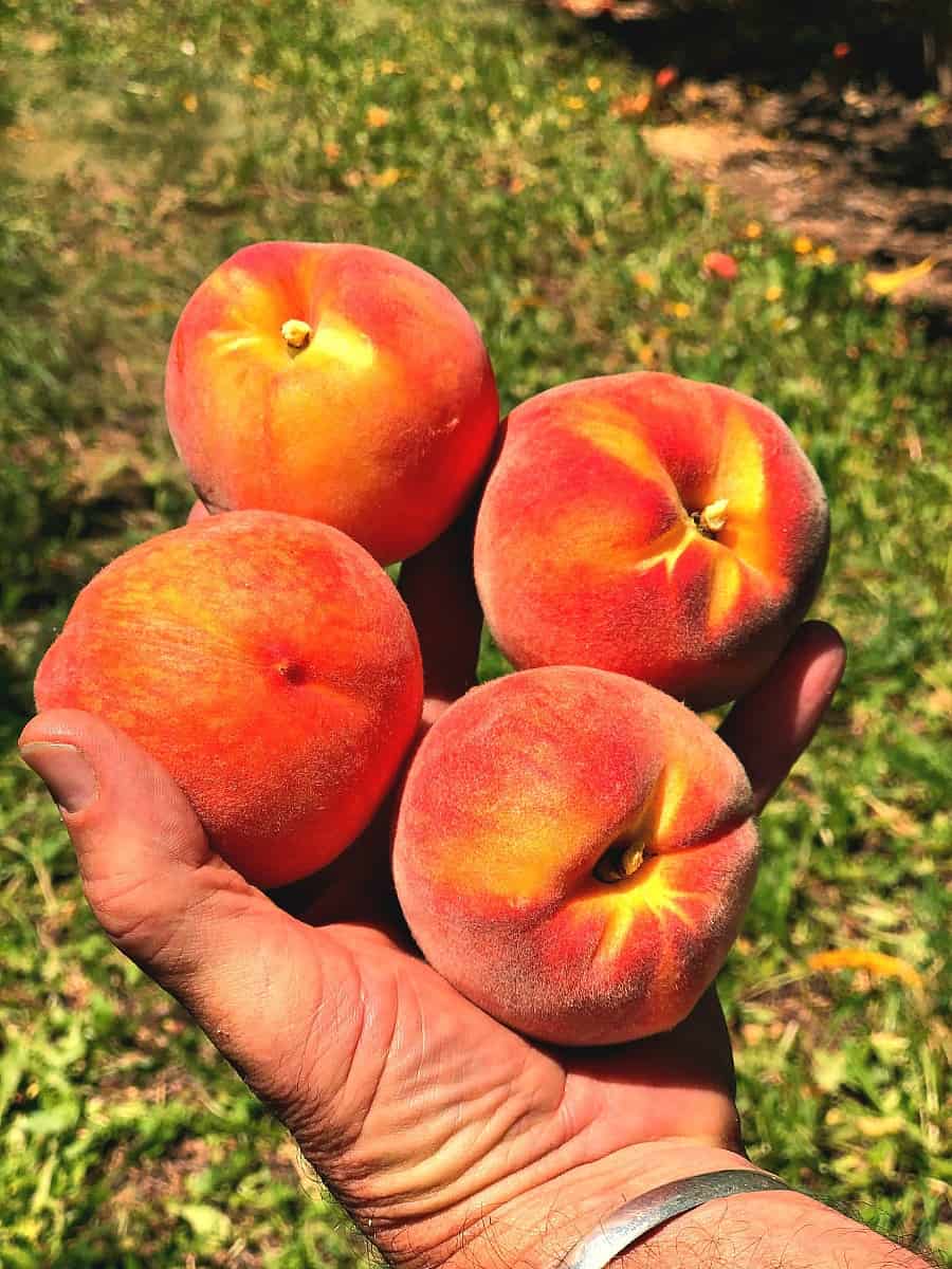
Check that off the list! We picked fresh peaches right from the tree! They were delicious!
The views of the farmland in this part of Colorado are impressive. This area of the state is rich in fruit production, coal mining and raising cattle.
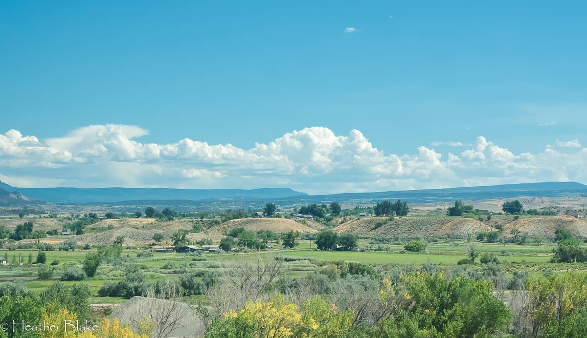
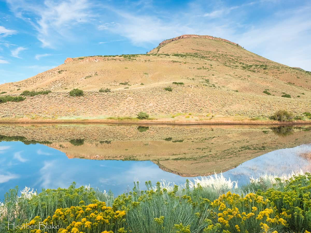
Crawford, Colorado
After leaving Paonia, we continued on the West Elk Loop Scenic Byway towards Hotchkiss and onto Crawford. Crawford is a cute ranching community where cattle drives are common and where you still may see cowboys walking down the street. They have a great library (if you need to get on the internet) and a few shops. Other than that it’s a sleepy little town.
Crawford, however, does have a state park (camping available) and it’s where to enter the North Rim of the Black Canyon of the Gunnison National Park along with fabulous views of Needle Rock.
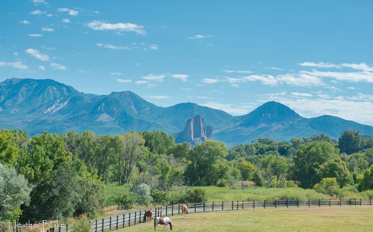
After passing through Crawford, Colorado and basically across from the north entrance of the Black Canyon National Park you will see this prominent landmark! Complete with horses of course!
Black Canyon of the Gunnison National Park
The good thing about taking the West Elk Loop Scenic Byway is that you get to see the Black Canyon of the Gunnison National Park from the north rim. This is important because its the least crowded side of the park. In fact, I think we only saw 1 other person enjoying the park the day that we were there. There was no one manning the ranger station and there were only a few campers in the campground! Wow! That was cool!
This National Park is quite impressive and well worth it to stop! Check out these photos!
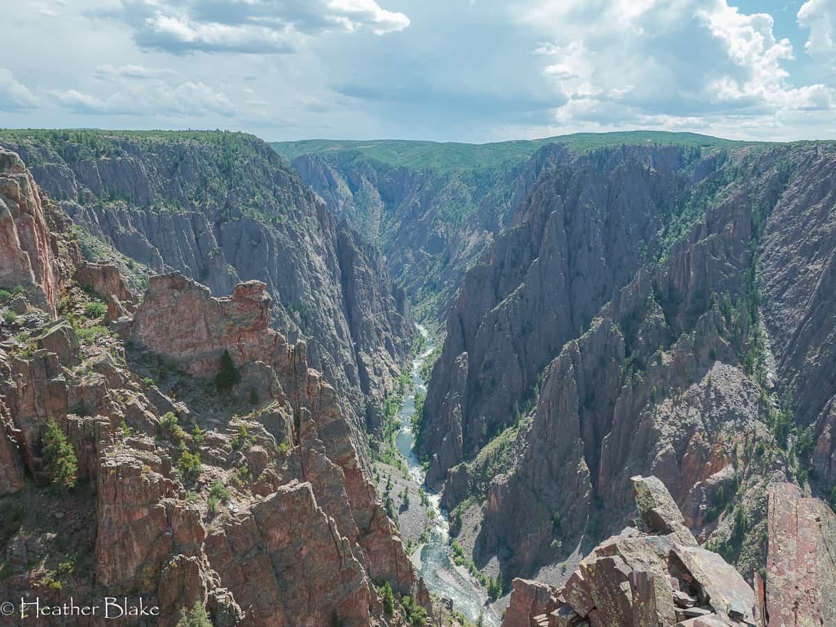
The Black Canyon of the Gunnison National Park is awe-inspiring! Wow! This is a deep canyon. This picture was taken from the North Rim and the best part, no people! I think we only saw one person who happened to be reading a book in the parking lot at one of the overlooks! Not a bad spot I’d say!
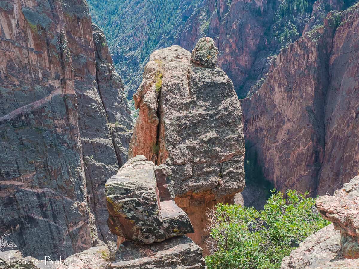
I wonder how many “balanced rocks” are out there? I’m pretty sure that on every trip we see a balanced rock! Funny, but this one just happens to be a 1000 feet up!
National Forest access in the area
There is plenty of dispersed camping in this area through national forest access. A local man suggested that we camp off Crystal River Road. He was right. We found a beautiful flat spot up about 10 miles or so. Again, the road was fine for our size RV and you could definitely make it in something a little bigger but I wouldn’t take a 40-footer as the turn arounds would be tough! It was just beautiful!
Crystal Creek Road is a bumpy dirt road that takes you back to some fabulous boondocking sites! The road takes you across some private lands but it keeps going as it will end up into the National Forest. Make sure you give a wave to all the cows that are everywhere!
Curecanti National Recreation Area
As with any trip that we have taken, there is always that “one” surprise place that you have never heard of before and that takes your breath away. Curecanti National Recreation Area was that place. It’s an amazing drive that takes you very high, then very low to the valley and reservoirs. It’s incredible. With every turn of the road, there is a better view than the last.
There is a ton of camping in this area, unfortunately, it’s all paid camping because its part of the NPS. One thing that I have never seen before is “boat” in camping! That’s crazy. Click on the link to see all the places to camp. We camped in a primitive spot and paid $15 for the night! It was totally worth it!
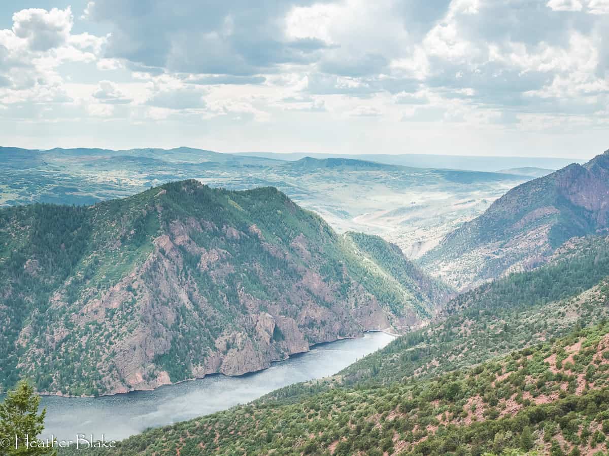
Marrow Point Reservoir hugs the south side of the Curecanti National Recreation Area. This road is super curvy, steep and offers tremendous views. Look in the photo and you can see the road in the background. The road really climbs!
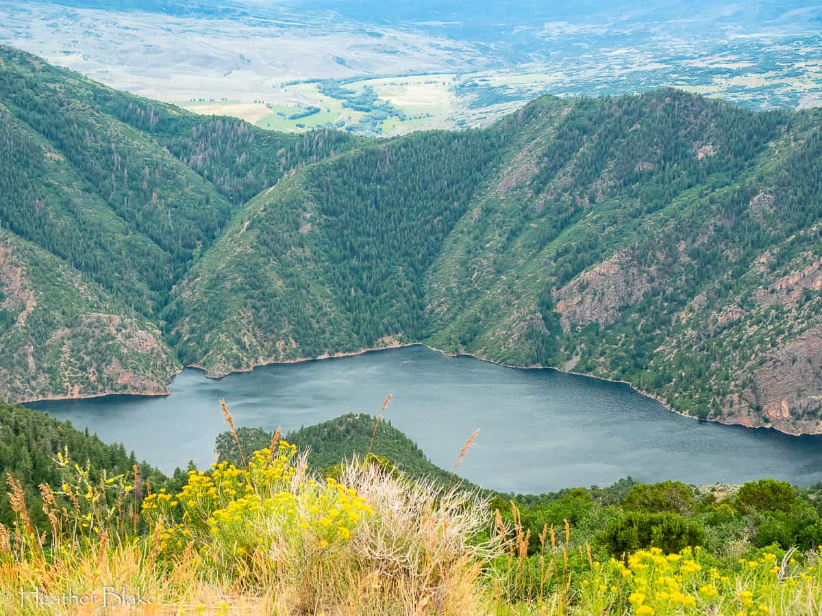
Pioneer Point was definitely worth a stop on the West Elk Loop Scenic Byway. Wow! Check out this view Crystal Reservoir!

If you follow my posts, you will know that we always encounter unexpected surprises. Blue Mesa Reservoir was one of them! It’s gorgeous down there and I had no idea it existed even though it’s only 4-hours away! Blue Mesa Reservoir also happens to be the largest body of water in Colorado! It’s 20-miles long! Wow!
I love this picture taken early in the morning near our camp spot near Blue Mesa Reservoir. The morning was completely still as seen here! Just beautiful, we had to stop the car to get a picture of this!
Gunnison, Colorado, Monarch Pass and Back to Denver
This part of the trip is where we deviated of course of the West Elk Loop Scenic Byway as it is the most sensible way for Denverites to get back home.
Two things that you must do on this part of the trip are to stop in Gunnison and stop on the top of Monarch Pass.
Gunnison seriously looks like a town straight out of a John Wayne movie. The town is bustling with locals and has a vibrant downtown with tons of shopping, restaurants, coffee shops and bars. I was amazed by how busy the town was in a really good way. We hung out for a bit and enjoyed an early morning milkshake that we got (of all the strange places to get a milkshake) a local antique shop. It was delicious.
After leaving Gunnison, we headed over Monarch Pass. Monarch Pass is considered to have one of the best views in the state. It sits on the continental divide (3rd crossing on this trip) and even has an aerial tram at the top that you can take if you want even better views! Make sure to stop in the family-owned gift shop to check things out! It’s cute and quirky!
Finishing up the trip!
After coming down from Monarch Pass we headed back up to Buena Vista, over to Fairplay and home. This was a tremendous trip that took us 4-days to complete. We certainly took advantage of seeing all that we could. I wouldn’t have done it any other way!
Thanks for reading along!
Monarch Pass was the last of the BIG mountain passes that we took on this adventure. It crosses the Continental divide and offers jaw-dropping views! It’s steep and curvy so watch your speed!
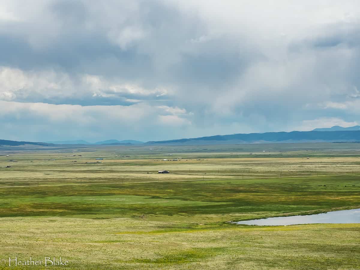
The view coming down from Kenosha Pass into South Park. This is one of my favorite views and I am lucky enough to be able to see it a few times a year! It never gets old. This valley sits between 9000-10000 feet!
Want more travel ideas? Check out some past posts!
The Big Southwestern Adventure
The Big Southwestern Adventure- Arizona
Exploring the Northern Rockies